


Hurricane Dorian continues powerful crawl across Bahamas
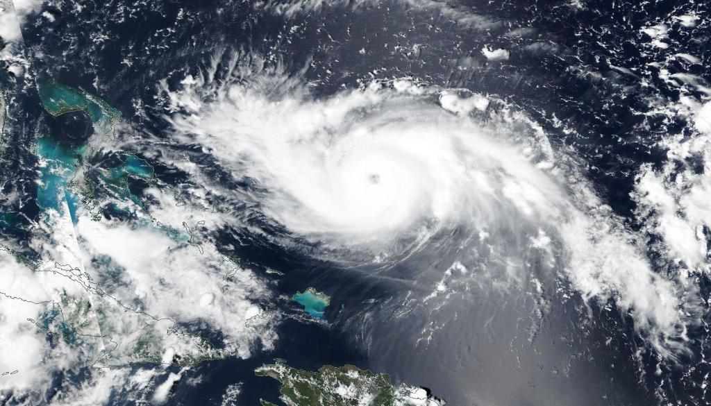
With maximum sustained winds of around 150 mph, Hurricane Dorian continued its crawl across the Northwestern Bahamas Monday morning, moving west over Grand Bahama Island at only 1 mph.
Monday's wind speed is down from the 185 mph maximum sustained winds that hit Abaco Island on Sunday.
Sunday’s wind speeds made Dorian tied for the most powerful Atlantic hurricane on record with the Labor Day hurricane of 1935 — before storms were named.
"Although gradual weakening is forecast, Dorian is expected to remain a powerful hurricane during the next couple of days," the National Hurricane Center (NHC) said in a 2 p.m. EST update.
Hurricane-force winds reach 45 miles from the storm's eye, and tropical storm-force winds stretch up to 140 miles out, according to the NHC.
Little information has come out of the affected islands since Dorian made landfall. Officials expect many residents to be left homeless. As the storm approached, most people went to shelters, tourist hotels shut down, and residents boarded up their homes. As of the country’s 2000 census, Grand Bahama Island had a population of 46,994 and the island chain, overall, was populated by 303,611 residents.
"A life-threatening storm surge will raise water levels by as much as 18 to 23 feet above normal tide levels in areas of onshore winds on Grand Bahama Island," the NHC warned Monday. "Near the coast, the surge will be accompanied by large and destructive waves. Water levels should very slowly subside on the Abaco Islands during the day."
The NHC predicted 12 to 24 inches of rainfall in Northwestern Bahamas through the end of the week, with 30 inches possible in isolated areas. The Carolina coast may get 5-10 inches, with 4-8 inches for the Florida and Georgia coast.
"This rainfall may cause life-threatening flash floods," the NHC said.
The east-central coast of Florida could even see isolated tornadoes, forecasters warned.
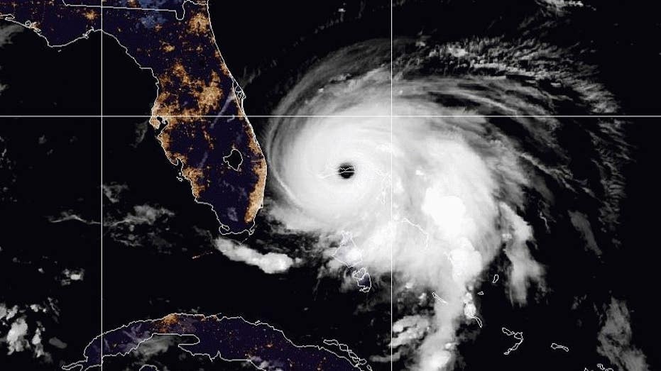
Forecasters predict Hurricane Dorian is expected to begin pulling away from The Bahamas early Tuesday, turning north along the southeastern coast of the United States. The storm is expected to stay near the shoreline, hitting coastal towns with dangerous winds and heavy surf. Authorities continue to warn that Dorian could still make landfall.
"Tropical-storm-force winds are mostly likely to start in Georgia early on Wednesday, in South Carolina late Wednesday, and in North Carolina early Thursday," the National Hurricane Center tweeted Monday morning.
South Carolina Gov. Henry McMaster issued a mandatory evacuation order for his state’s 830,000 coastal residents, which is scheduled to take effect at noon Monday. Authorities in Florida similarly ordered evacuations for vulnerable coastal areas and Gov. Roy Cooper of North Carolina has warned his state of possible heavy rain, wind and floods later in the week.